Visit Carleton! Book your tour today.
Program Details
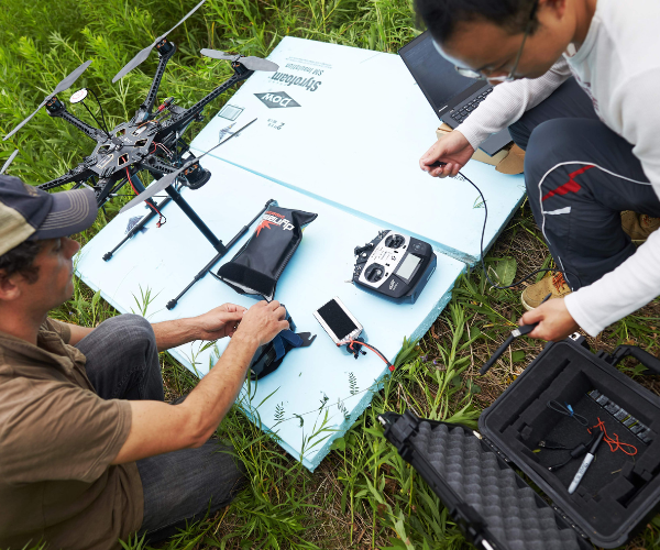
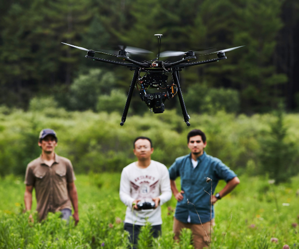
In the Bachelor of Science (BSc) in Geomatics, you will obtain intensive science-based training in geographic information systems (GIS), remote sensing (imaging from satellites, piloted aircraft and drones), Global Navigation Satellite System (GNSS), land surveying and cartography including desktop, web-based and mobile applications. Apply advanced computer software and techniques to improve our understanding and management of the Earth’s physical and natural systems.
The BSc in Geomatics includes training and course electives in relevant physical or natural science disciplines including computer sciences. A Bachelor of Arts in Geomatics is also available.
Capital Advantage
Ottawa is rich in study resources such as the Canada Centre for Remote Sensing, Statistics Canada and other federal government departments. Ottawa’s extensive research and information technology activities also provide exciting opportunities for our students.
Exceptional Learning and Research Facilities
Learn specialized computer software (ESRI ArcGIS, GIS and database management systems, Earth Engine and Google Earth) and hardware (GIS workstations, GNSS technology, camera systems, drones, smartphones and other mobile platforms).
You will have access to the latest in teaching laboratories at Carleton, including two geomatics laboratories as well as extensive faculty research tools and infrastructure that are also used to enhance undergraduate teaching opportunities in senior years. The Carleton library houses extensive resource materials, including a collection of over 166,000 digital and paper maps.
Work Experience
Combine hands-on learning using modern laboratory facilities with field experience in Co-op and work placements.

Get started in Carleton360 to receive tailored information on our programs, student services and community.
Career Outcomes
Explore your passions, refine new skills and discover the career that’s right for you.
As a Geomatics (BSc) graduate, you will have a strong theory and application base that makes a range of career possibilities available to you.
Sample Courses
GEOG 1010 - Global Environmental Systems
Principles, processes and interactions in the Earth's environment emphasizing the flow of energy and matter within global systems. Atmospheric and oceanic processes, earth surface processes and biogeochemical cycling. Case studies on the interaction between human activity and the natural environment.
CIVE 2004 - GIS, Surveying, CAD and BIM
Engineering geometry and spatial graphics. Fundamentals of surveys. Digital surveying tools; total station, GPS. Computer-Aided Drafting (CAD). Geographic Information Systems (GIS). Spatial referencing. Building Information Modelling (BIM). Integrated design using digital tools. Field exercises using software to process and evaluate spatial data.
Visit the Undergraduate Calendar to view a comprehensive list of course offerings for this program and discover the exciting things Carleton students are learning in the classroom!
The faculty from the Geomatics program encouraged, guided and supported me in the pursuit of my dreams of working in the space field. While at Carleton I was afforded the opportunity to design and fly airborne remote sensing equipment. I was also supported in my Unmanned Aerial Systems (UAS) research and development throughout my degree. This foundation of education and practical experience was instrumental in helping me land a job with an Ottawa-based spaceflight engineering company. It was there where I worked on the development, integration and operation of lunar rover sensors along with vision systems for autonomous vehicles and underwater survey equipment.