Visit Carleton! Book your tour today.
Program Details
In the Bachelor of Arts (BA) in Geomatics program, you will obtain intensive training in geographic information systems (GIS), remote sensing (imaging from satellites, piloted aircraft and drones) and cartography. You will use geospatial data analysis to examine urban planning and transportation issues (e.g. infrastructure management, socioeconomic mapping, business analysis and sustainability planning), ecosystem and environmental resource management (e.g. forestry, agriculture, water resources) and public health and security (e.g. geohazard mapping, disease spread, crime analysis).
Geomatics can also be taken as a Bachelor of Science program. An Honours program and a minor in Geomatics are offered.
Capital Advantage
Ottawa is rich in study resources such as the Canada Centre for Remote Sensing, Statistics Canada and other federal government departments. Ottawa’s extensive research and information technology activities also provide exciting opportunities for our students.
Exceptional Learning and Research Facilities
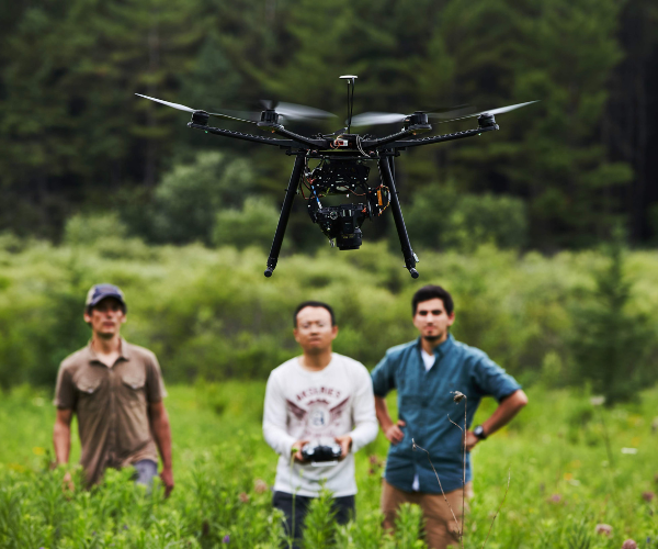
Become proficient with industry-standard software tools like Google Earth and Earth Engine, ESRI ArcGIS Pro, QGIS. You will also work extensively with cutting-edge hardware tools and systems including GIS workstations, GNSS technology, camera systems, drones, smartphones and other mobile computing platforms.
You will have access to the latest in teaching laboratories at Carleton, including two geomatics laboratories as well as extensive faculty research tools and infrastructure that are also used to enhance undergraduate teaching opportunities in senior years. The Carleton library houses extensive resource materials, including a collection of over 166,000 digital and paper maps.
Work Experience
You will have the opportunity to gain field experience in Co-op and work placements.


Get started in Carleton360 to receive tailored information on our programs, student services and community.
Career Outcomes
Explore your passions, refine new skills and discover the career that’s right for you.
As a Geomatics (BA) graduate, you will have a strong theory and application base that makes a range of career possibilities available to you.

Sample Courses
GEOG 1020 - People, Places and Environments
Introduction to human geography. Examination of relationships between people, communities, society and the natural environment at local to global scales. Population change, cultural patterns, and historical, economic, political and environmental forces, including climate change, that shape human activity and experiences from place to place.
GEOM 3007 - Cartographic Theory and Design
Principles of and issues in cartography, cartographic communication and map design; practical aspects of cartographic representation using multimedia and online/interactive mapping.
Visit the Undergraduate Calendar to view a comprehensive list of course offerings for this program and discover the exciting things Carleton students are learning in the classroom!